
Municipality develops integrated system to classify Dubai assets in a comprehensive geospatial dictionary
20 June 2021
The GIS Center in Dubai Municipality has developed an integrated system for classifying Dubai assets in a comprehensive geospatial dictionary.
The move comes within the framework of the directives of His Highness Sheikh Hamdan bin Mohammed bin Rashid Al Maktoum, Crown Prince of Dubai and Chairman of the Executive Council, to transform the Government of Dubai into a fully smart model and make Dubai the address of smart cities in the world.
It is also in implementation of the GIS Center’s tasks related to collecting the emirate’s basic and detailed geographic data and digital information, including descriptive ones, classifying this data and information, setting technical controls with the asset owners, and then providing geographical data, information and a dictionary to it within the limits of agreements and memoranda of understanding concluded between the center and the owners of these assets, data and information.
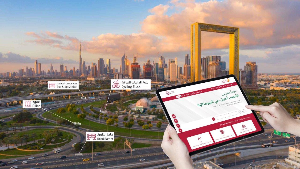
Categorizing Dubai’s assets in a comprehensive geospatial dictionary is one of the initiatives implemented by the GIS Center in Dubai Municipality from 2018 onwards. It aims to develop the traditional image of base maps, to include all assets created on the ground in a 3D digital twin manner that includes all government assets with a fixed spatial dimension, whether they are above or below the ground. As in the case of infrastructure and service lines, where the location of the asset represents a basic dimension of the value of the asset. The assets were classified in an electronic geospatial dictionary with images that serve the requirements of Dubai government in terms of listing them in a unified geospatial database of government assets, which represents a real wealth estimated at billions of dirhams for the emirate, to simplify access to it, and geospatially analyzing and managing it with the latest available geospatial methods.
The Update App is the application through which the new or existing assets in the dictionary are updated. It is used by the geospatial dictionary staff, to add, modify or delete any detailed stage of the data in addition to the accompanying images according to the modification in the geospatial database. Dubai’s assets and its dictionary are displayed through the “Dubai Here” system, which was developed by the GIS Center as a comprehensive portal for displaying and analyzing the geospatial statistics data, the most important of which is asset data, in an easy way, smooth classification and an easy-to-use search engine to access data. The assets in the “Dubai Here” system are displayed in detail according to their owner, and the assets that are currently available as data included in the dictionary. The system was designed to add any other assets in the future.